
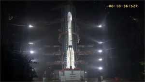
New Delhi. The Indian Space Research Organisation (ISRO) launched the EOS-05 satellite into space using the GSLV-F17 rocket from the Satish Dhawan Space Centre. Also known as GISAT-1A, this satellite weighs approximately 2,367 kilograms. The launch took place on September 4, 2026, at 2:55 AM from the space centre’s second launch pad. This marks the 19th flight of the GSLV and is considered the heaviest payload to date. It represents a significant comeback mission for ISRO following an eight-month hiatus.
What EOS-05 Will Do
EOS-05 is India’s first imaging satellite designed to operate from a geostationary orbit. It will remain stationary at an altitude of approximately 36,000 kilometers above Earth, continuously monitoring the Indian subcontinent. Conventional remote sensing satellites orbit at lower altitudes and can typically capture images of a specific location only once every few days.
In contrast, this satellite will be capable of capturing images of the entire Indian landmass every 30 minutes. For critical areas, this interval can be reduced to just five minutes. It is equipped with a 700-millimeter telescope designed to collect data across visible, near-infrared, and short-wave infrared bands.
This satellite will prove invaluable for disaster management, enabling real-time monitoring of events such as floods, cyclones, and forest fires. In the agricultural sector, it will facilitate the assessment of crop conditions, soil moisture, and vegetation health. Additionally, it will aid in national security and environmental monitoring. Under cloud-free conditions, it will provide frequent imagery of large areas, offering planners and scientists access to precise information. A Comeback After the 2021 Setback
In 2021, the GISAT-1 (EOS-03) satellite failed to reach orbit during the GSLV-F10 mission due to a malfunction in the cryogenic stage. EOS-05 represents an attempt to regain that capability. The GSLV-F17 is a three-stage rocket standing 51.7 meters tall with a lift-off weight of 420.5 tonnes.
It will deploy the satellite into a sub-geosynchronous transfer orbit, from where the satellite will maneuver itself into its final orbit. This mission will elevate India’s space capabilities to new heights. Geosynchronous imaging will provide the country with a continuous monitoring tool—a capability it previously lacked.
It will strengthen disaster response, agricultural planning, and security systems. This move by ISRO will prove to be another significant milestone in the journey towards an ‘Atmanirbhar Bharat’ (Self-Reliant India). Due to its history of failures, this rocket is nicknamed the “Naughty Boy.”
Share:













Indore (HO)
Bhopal
Jabalpur


©2026 Agnibaan , All Rights Reserved